April 15 – day 7 – zero miles today
Had a relaxing and rejuvenating day with excellent home-cooked breakfast, dinner and craniosacral therapy by Chery.
April 16 – day 8 – camped mile 115 – hiked 13.7 miles
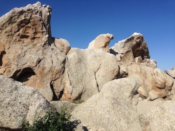
It was a great day which started with another wonderful breakfast prepared by Chery. I first passed through lovely active cattle ranch country. The oak and grass savanna opened up completely before I reached Eagle Rock. This natural outcrop looks remarkably like its namesake eagle with wings partially outstretched.
Later the trail meanders through gorgeous riparian forest of sycamore, cottonwood and oak.
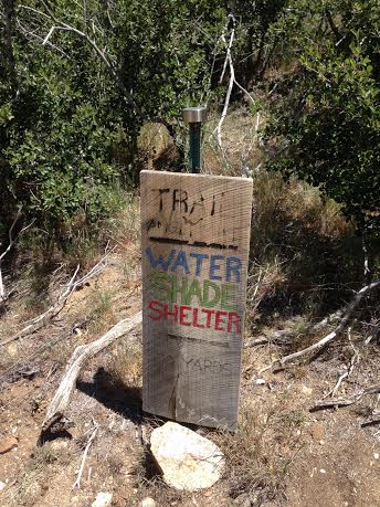
I reached the community center at Warner Springs in the late morning. The center is set up in season as a PCT hiker oasis. They offer water, showers, laundry, camping, re-supply food, etc. for sale in a mini store. They even prepare meals to order. I arrive a little too early for a burger but hung out long enough to get one. There were loads of thru-hikers there and many community members acting as trail angels. All in all it was a heartwarming scene.
I didn’t make it too much beyond Warner Springs as I wanted to camp along the trail side creek.
This section — from S22 near Ranchita on through to Highway 79 near Warner Springs and on to Agua Caliente creek where I camped — I again recommend to my friends and family in Southern California. The terrain is easy walking and the scenery is beautiful.
April 17 – day 9 – camped mile 136.8 – hiked 21.8 miles
 This was a grueling day. I quickly left the river valley that I had camped in and ascended into the dry hills. I get to trail angel Mike’s place around mid-day. He provides water and a place to relax at his remote ranch right off the trail. I met only five thru-hikers there and for the second time here, no Mike. I continue on to Tule spring/tank where I camp for the night.
April 18 – day 10 – off-trail mile 151.7 – hiked 15.9 miles
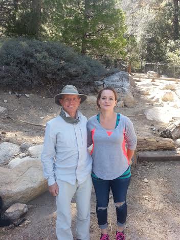
I was up early in order to meet my niece Nicole and her son Chris at the Paradise Valley Cafe on Highway 74. Luckily I did not get there too early otherwise the wait for my burger would have been too painful.
SMS: I am in Paradise and they have beer and burgers.
I spent the rest of the day with my family at my sister Lauri’s house in Lake Elsinore eating as much as I could. I like that so much I decided to take a zero tomorrow.
April 9 – day 1 – camped mile 15.2
My dear sister Lauri dropped me off at the trailhead. Day one was much harder than I remember. My shoulders and hips are very sore. Camped by the dry Hauser Creek which is where I camped day one in 2013. I went to sleep just after sunset.
April 10 – day 2 – camped mile 32.2 – hiked 17.1 miles
Another hard day readjusting my body to the pack. Camped on a bed of live oak leaves. Went to sleep just as it was getting dark.
April 11 – day 3 – camped mile 45.3 – hiked 14 miles
It was a great day today. Ascended through forests up to Mt. Laguna where I had my first trail burger and fries. Not too impressive for a “Mountain Burger” but there will be plenty of burgers in my PCT future. Had a wonderful camping spot with a commanding view overlooking Anza-Borrego Desert State Park.
April 12 – day 4 – camped mile 65 – hiked 19.7 miles
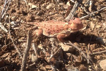 Got going early and enjoyed the spectacular views of the desert below. Had a good long break at Sunrise Trailhead where I ate my favorite trail meal: red beans and rice. After that I started the long descent toward Scissor Crossing. Saw my fourth horny toad this afternoon — very small and golden. Found a dry wash to camp in.
April 13 – day 5 – camped mile 80.7 – hiked 15.7 miles
It was a hot day today. Got to the low point at Scissor Crossing at noon. I was so happy that there was a tiny water cache there under the Highway 78 bridge. This cache was supposed to have been removed by the Anza-Borrego rangers. There was one thru-hiker when I got there and about nine when I left. I started walking again in the late afternoon up into the dry San Felipe Hills.
April 14 – day 6 – camped off trail mile 101.3 – hiked 20.6 miles
The San Felipe Hills that I am walking through today are one of the driest sections of the trail. Got water at the third gate water cache. I take off again when there are about ten thru-hikers tanking up there. Barrel Springs, the next water source, is just off S22 west of Ranchita. I head a mile and a half east on the Montezuma Highway toward Mountain Valley Retreat in Ranchita. It’s a perfect stop. I shower, do my laundry, pick up my resupply package, and have a delicious meal of chicken veggie soup, slaw, bread and butter, and a glass of Pinot to top it off.
I’ve got my pile of stuff ready for the trip.
Now comes the process of weighing new items and making the spreadsheet.
My sister is dropping me off at the start of the trail on Thursday and will meet up with me roughly 10 days later. I’m putting together a box of what I might want 10 days out (city clothes, spare food, fuel). I’m also putting together a resupply box to ship to the Mountain Valley Retreat near Barrel Springs.
Contacted my buddy Dave who is planning to hike the JMT in July/August. Too bad I will probably be well north of there by then, so we won’t meet up. We did cycle touring in Washington state and many river kayaking trips together back in the 80s.
Thanks to everyone who came to my “happy trails” party last night. I had a fantastic time, graciously hosted by our wonderful neighbor Sandra.
The party was not too big and everybody seemed to be talking to each other. I made my rounds.
Lots of friends are interested in my trip, either just hearing about it or actually doing it themselves someday.
People ask about:
Some people looked at the trail map and took PCT postcards home with them (postcard-sized maps of the entire trail). Looking at the map I remember the scenes, scenery and people from all the different sections of the trail. I’m ready to hit the trail again.
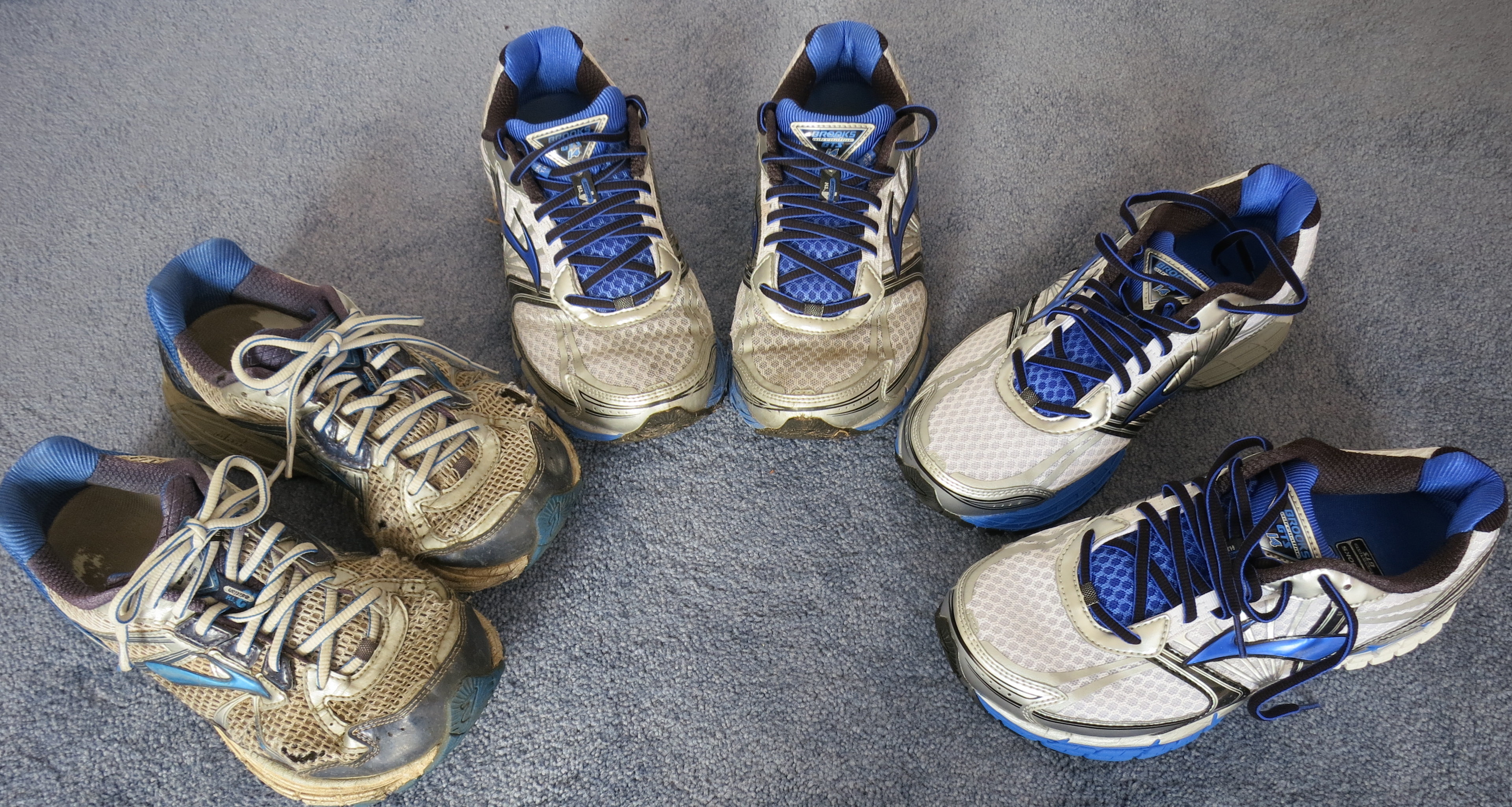
I expect to wear out at least three pairs of shoes.
These are my favorite. Same ones I wore last time. Brooks GTS 14 running shoes, 4E extra wide.
Preparing for the PCT again.
I got my permit that says my official start date is April 9, 2015.
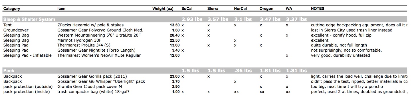
In these next few days I’ll be building a more complete gear list spreadsheet and making gear assessments based on my experience. Here is a snapshot of what hikers call “the big three”: sleep system, shelter system, and pack.
Tent: ZPacks Hexamid Solo w/ screen
This is cutting edge backpacking equipment. Less than one pound for everything: tent body, pole, stakes, ropes, and ground cloth. Very good ultralight tent, does what it needs to do. Not surprisingly, it is expensive. It’s not quite enough for heavy rains, but fine for moderate or less rain.
Sleeping Pad: Thermarest Women’s NeoAir XLite Regular
I splurged on a NeoAir that fit me perfectly (about 5’6″). It’s very nice to have a full length sleeping pad, particularly when the ground is potentially very wet. Since I only used it in Washington, I can’t attest to its durability. I can say that the 10+ year old ProLite that I was using before was very durable, but the NeoAir was way more comfortable.
Sleeping Bag: Western Mountaineering UltraLite (20°F)
If I were only bringing one bag, this would be it, for sure. This bag is light, warm, comfortable, with a very good hood. I like that WM bags have smaller sizes, so you don’t have to carry extra bag length that you’re not using. I got the 5’6″ version.
Sleeping Bag: Marmot Hydrogen (30°)
This is the first generation Hydrogen. They don’t make them this well anymore. Perfect for summer-like conditions, very light, but is only reasonable for the warmest portion of the trip (for mid-summer I was in Northern California).
Pack protection that doubles as ground cloth: white trash compactor bags
During the parts of the trip where there was rain or chance of rain, I put these bags to line the inside main compartment of the pack to keep everything dry. These are very heavy plastic bags that I replaced about every 1000 miles or so. After I lost my Polycryo ground cloth in Sierra City, I started laying out 2 plastic bags end-to-end as ground cloth inside my tent. That ended up being a good pack liner and a good ground cloth.
Pack: Gossamer Gear Gorilla (earlier version, pre-2012)
For most of this trip I used my girlfriend’s Gossamer Gear Gorilla pack, which was nice and light and distributed the weight quite well. (It does have a tiny metallic internal frame.) Better than my GoLite Jam. However, in parts of the trail I was challenged due to it’s limited capacity. (About 39L in the main compartment with a max recommended capacity of 35 lbs.) At my heaviest I was probably 33lbs leaving Kennedy Meadows (9 days of food in the Sierra with a bear canister.) It’s a reasonable sized pack, but I had to be careful not to carry too much stuff. The limited volume was a challenge. Fine for lightweight backpacking. Don’t have too big of a pack, because somehow miraculously it gets filled up.
Well I decided that I was just too under-equipped to tackle the next sections so I am off the trail for the year.
The conditions are early winter up high so I would need a warmer sleeping bag, 4 season tent, extra clothes, backcountry skis, boots, high gaiters, climbing skins, poles, ice axe, crampons, stove and pot etc.